Mt. Lafayette, Mt. Lincoln, Little Haystack Mtn.
| Mountains: | Little Haystack Mtn. (4760'), Mt. Lincoln (5089'), Mt. Lafayette (5260') | |
| Trails: | Falling Waters Trail, Franconia RidgeTrail, Greenleaf Trail, Old Bridle Path, Appalachian Trail | |
| Region: | NH - Central East White Mountain National Forest, Franconia Region | |
| Location: | Franconia, NH | |
| Rating: | Difficult | |
| Features: | Summits, views, cascades, waterfalls, hut, brooks, 4000-footers, loop hike | |
| Distance: | 8.8 miles | |
| Elevation Gain: | 3860 feet (cumulative) | |
| Hiking Time: | Actual: 7:30 Typical: 7:20 | |
| Outing Duration: | Typical: 11:00 | |
| Season: | Fall | |
| Hike Date: | 10/21/2000 (Saturday) | |
| Last Updated: | 09/01/2019 | |
| Weather: | A little hazy, comfortable 35-40 degrees, sunny | |
| Author: | Webmaster | |
| Companions: | SDHrs: Rachel B, Rich S, Dennis M, Marj W, Pam S, Heather, Kathy L, Doris G, John G. |
Route Summary
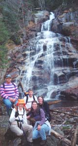
This is a loop hike starting and ending at the Lafayette Place parking area. It summits Little Haystack Mountain, Mount Lincoln and Mount Lafayette, all of which rise well over 4,000 feet (over 5,000 for Lincoln and Lafayette) and offer staggering views. The 1.6-mile segment between Little Haystack and Lafayette is atop an open ridge. During the ascent on Falling Waters Trail, there is about a half-mile stretch along Dry Brook where you will be treated to several cascades, including Stairs Falls, Swiftwater Falls (60 feet), and Cloudland Falls (80 feet).
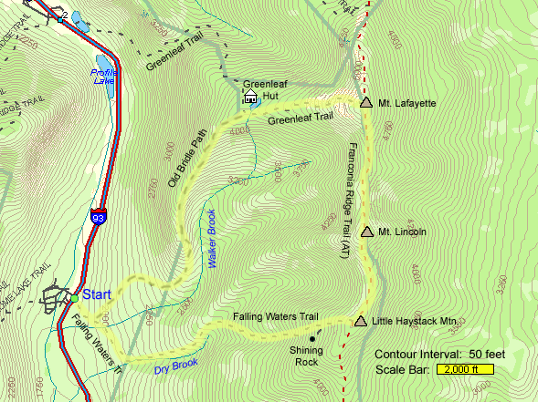
- Start out on Falling Waters Trail (which for the first 0.2 mile is also the same trail as Old Bridle Path).
- After 0.2 mile, turn right to stay on Falling Waters Trail and follow that until its end on Little Haystack Mountain, 3.2 miles from the parking area. The first mile of this trail is pretty easy but then becomes quite steep. About halfway up this trail you will start passing a series of pretty cascades.
- From the end of Falling Waters Trail, turn left onto Franconia Ridge Trail which is also part of the Appalchian Trail (AT).
- Follow Franconia Ridge Trail/Appalachian Trail on moderate grades 0.7 mile up to the summit of Mount Lincoln.
- Continue on Franconia Ridge Trail/Appalachian Trail across moderate grades for 0.9 mile which will lead you down the other side of Mount Lincoln and then up to Mount Lafayette's summit.
- From Mount Lafayette, turn left to descend on Greenleaf Trail, being careful to avoid Garfield Ridge Trail which goes straight ahead.
- Descend steeply on Greenleaf Trail for 1.1 miles until reaching Eagle Lakes and Greenleaf Hut.
- Turn left to get on Old Bridle Path.
- Follow Old Bridle Path for 2.9 miles all the way back to the parking lot (upon reaching the junction with Falling Waters Trail 0.2 mile before the parking lot, turn right). Most of the descent will be on steep grades but the last mile eases up considerably.
| Place | Split Miles |
Total Miles |
Split Time |
Total Time |
|||||
|---|---|---|---|---|---|---|---|---|---|
| Falling Waters Trailhead (1780') | 0.0 | 0.0 | 0:00 | 0:00 | |||||
| Little Haystack Mtn. summit (4760') | 3.2 | 3.2 | 3:00 | 3:00 | |||||
| Mt. Lincoln summit (5089') | 0.7 | 3.9 | |||||||
| Mt. Lafayette summit (5260') | 0.9 | 4.8 | 1:00 | 4:00 | |||||
| Greenleaf Hut and Eagle Lakes (4220') | 1.1 | 5.9 | |||||||
| Old Bridle Path trailhead (1780') | 2.9 | 8.8 | 3:30 | 7:30 |
|
|
|||||
|
|
|||||
Trail Guide
The weather gods were smiling down on Franconia Ridge this past Saturday, providing perfect hiking conditions for the ten ambitious souls that tackled three 4,000-footers in one fell swoop. Most of the day was spent garbed in a single layer with some adding a jacket when we got above treeline where the gusting wind frequently knocked us off balance.
 The climb up Falling Waters Trail was steep but was tempered by the sight of several
beautiful cascades, including the 80-foot drop of Cloudland Falls. After leaving the
brook, the trail continued up among hemlocks with lush green mosses flourishing along the
forest floor. The entire path was rocky, prompting the suggestion to change the name to
"Falling Rocks Trail".
The climb up Falling Waters Trail was steep but was tempered by the sight of several
beautiful cascades, including the 80-foot drop of Cloudland Falls. After leaving the
brook, the trail continued up among hemlocks with lush green mosses flourishing along the
forest floor. The entire path was rocky, prompting the suggestion to change the name to
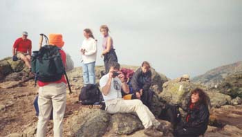
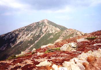
"Falling Rocks Trail".After breaking treeline, we quickly reached the top of Little Haystack at 4,760 feet. The summit rock afforded views in every direction as well as complete exposure to the ferocious wind. Although it was somewhat hazy, the number of mountains that presented themselves was striking. After being battered by the blasts, we stepped down to the lee side of the boulder and enjoyed a leisurely lunch.
 Having replenished our energy, we worked our way across the ridge in high spirits. While
Pam had her arms spread open, reveling in the glorious day, a passerby surprised her with
a hug, making her day even brighter. We peaked Mount Lincoln at 5,089 feet. Following
that, we found some patches of snow and had a couple snowball skirmishes. And finally
we conquered the highest peak of the day: Mount Lafayette at 5,260 feet. While walking
the ridgeline, we enviously watched the crows riding the thermals - it looked like they
were having a blast.
Having replenished our energy, we worked our way across the ridge in high spirits. While
Pam had her arms spread open, reveling in the glorious day, a passerby surprised her with
a hug, making her day even brighter. We peaked Mount Lincoln at 5,089 feet. Following
that, we found some patches of snow and had a couple snowball skirmishes. And finally
we conquered the highest peak of the day: Mount Lafayette at 5,260 feet. While walking
the ridgeline, we enviously watched the crows riding the thermals - it looked like they
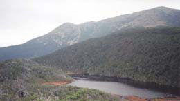
were having a blast.Reluctantly, we headed down the open rocks to make our way back to the parking area via Greenleaf Trail and Old Bridle Path. Pam was adding rocks to the cairns we passed in memory of cancer victims that she had worked with. We could see Marj way ahead of us because she was wearing a bright orange hunter's cap and informed us that hunting season starts tomorrow so we should take care when out in the woods. After a mile we reached Eagle Lakes (a small tarn and a bog) at Greenleaf Hut. The hut was closed for the season. Although the lake is small, it provided a great foreground to the towering ridges that we had just descended.
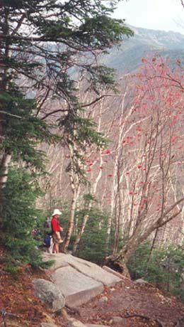
Entering the woods, Old Bridle Path was steep, rocky, and slippery for quite a distance. The nearly leafless woods furnished us with ample views out towards Cannon, Kinsman Ridge, and back to Franconia Ridge. We came upon a colorful grove where bright white birch trunks were intertwined with the vibrant red berry clusters of sumac. Other interesting trees included one that looked like a 3-legged table with a thick trunk sprouting out of it; and a beech tree covered in claw marks, marking it as a favorite of the bears.
The last mile was over comfortable grades and as we were nearing the end of the trail, we watched the sun tucking itself behind Kinsman Ridge, beautifully marking the end to great day.
|
|
|||||

 Driving Directions
The trailhead for this hike is located on the east side of Franconia Notch and is accessed from the Lafayette Place parking area on I-93 in Franconia Notch State Park. There are parking areas on both sides of the Parkway (I-93) with a foot-travel tunnel running underneath the highway connecting the two points.
Traveling northbound on I-93:
- Take I-93 North through Franconia Notch.
- Once in Franconia Notch State Park (where there is no median strip and the highway signs are brown instead of green), take the first exit after The Basin.
- After driving past The Basin parking area, you will see a sign for "Trailhead Parking 1/4 mile", and then the exit sign will simply say "Trailhead Parking". This is the Lafayette Place parking area even though it isn't signed as such from the highway.
- The trailhead is located directly off of this parking lot.
Traveling southbound on I-93:
- Take I-93 South through Franconia Notch.
- Once in Franconia Notch State Park (where there is no median strip and the highway signs are brown instead of green), take the first exit after Exit 34B.
- After driving past Exit 34B, take the next exit signed as "Lafayette Place Campground - Trailhead Parking".
- The trailhead is accessed by taking the pedestrian tunnel beneath the highway to the parking lot on the east side of the notch.
Other Notes
Franconia Notch Hiker Shuttle
Parking lots can fill up quickly in Franconia Notch State Park, especially on weekends and during foliage season. Parking alongside the road is not allowed. A hiker shuttle (about $5 roundtrip per person) is available to transport folks between the trailheads and a large overflow parking area. Please refer to the New Hampshire State Parks website to see details for the Franconia Notch Hiker Shuttle.
More Mt. Lafayette, Mt. Lincoln, Little Haystack Trail Reports
- Mt. Garfield, Garfield Pond, and Mt. Lafayette on 7/11/2009
- Mt. Garfield, Mt. Lafayette, Mt. Lincoln, Little Haystack Mtn., Mt. Liberty, Mt. Flume 2-day backpack on 5/21/2009
- Mt. Lafayette, Mt. Lincoln, Little Haystack Mtn. on 10/11/2008
- Cannon, Lafayette, Garfield, South Twin, Guyot, Zeacliff 5-day backpack on 6/20/2006
|
|
|||||
Website by
![]() LeapfrogProgramming.com
LeapfrogProgramming.com
© 1998-2025
![]()
| The information on this site may freely be used for personal purposes but may not be replicated on other websites or publications. If you want to reference some content on this site, please link to us. |