Destination
(Trails) | | Region Map | State | | | Features
(non-sortable) | Season | | Author |
|---|
Mt. Adams
(Air Line, Gulfside Trail, Appalachian Trail) (trail map, photos) | NH - Central East
White Mountain National Forest, Presidentials
Randolph, NH |  | NH | Difficult | 8.6 | views, summit, 4000-footer, alpine zone | Summer | 09/08/07
(10/02/08) | Mark Malnati | Adams Point Wildlife Management Area
(trail map, photos) | NH - Southeast
Seacoast Region
Durham, NH |  | NH | Easy | 1.4 | Great Bay, water views, loop hike | Variable |
(09/07/09) | Webmaster | Mt. Adams, Adams 4
(Lowe's Path, King Ravine Trail, Air Line) | NH - Central East
White Mountain National Forest, Presidentials
Randolph, NH | | NH | Difficult | 10.2 | summits, views, boulder caves, ice caves, 4000-footer, alpine zone | Summer | 07/24/99 | Webmaster | Mt. Adams, Mt. Madison, Madison Hut
(Air Line, Randolph Path, Gulfside Trail, Appalachian Trail, Air Line Cutoff, Osgood Trail, Pine Link, Valley Way) (trail map, photos) | NH - Central East
White Mountain National Forest, Presidentials
Randolph, NH | | NH | Difficult | 10.1 | views, summits, 4000-footers, hut, alpine zone, loop hike | Summer | 09/06/08 | Diane King | Alpine Garden
(Alpine Garden Trail, Optionally: Tuckerman Ravine Trail, Lion Head Trail, Huntington Ravine Trail, Nelson Crag Trail) (trail map, photos) | NH - Central East
White Mountain National Forest, Presidentials
Thompson and Meserves Purchase, NH | | NH | Easy/Moderate | 3.0 | views, alpine flowers, rare plant species, alpine zone | Spring | 06/15/08 | James Horner | Ammonoosuc Lake, Red Bench Viewpoint
(Around-the-Lake Trail, Red Bench Trail, Down to the Lake Spur) (trail map, photos) | NH - Central East
White Mountain National Forest, Willey Range
Carroll (Twin Mountain), NH | | NH | Easy | 1.8 | views, lake, loop hike, night hike | Winter | 01/31/08
(06/28/11) | Webmaster | Ammonoosuc River, Bath Covered Bridge, Waterfall
(Ammonoosuc Recreational Trail - Eastern Bath to Bath Center) (photos) | NH - Central West
Bath, NH |  | NH | Easy | 4.0 | river, covered bridge, waterfall, cascades | Winter | 12/24/06
(04/26/08) | Webmaster | Ammonoosuc River, Bath Covered Bridge, Waterfall
(Ammonoosuc Recreational Trail - Western Bath to Bath Center) (photos) | NH - Central West
Bath, NH | | NH | Easy | 3.4 | river, covered bridge, waterfall | Fall | 12/15/06
(04/26/08) | Webmaster | Arethusa Falls, Frankenstein Cliffs
(Frankenstein Cliff Trail, Arethusa-Ripley Falls Trail, Arethusa Falls Trail, Bemis Brook Trail) (trail map, photos) | NH - Central East
Crawford Notch State Park
Harts Location, NH | | NH | Moderate | 5.0 | waterfall, cascades, cliffs, brook, loop hike | Summer | 06/23/09
(10/28/09) | Bill Mahony | Arethusa Falls, Frankenstein Cliffs
(Arethusa Falls Trail, Arethusa-Ripley Falls Trail, Frankenstein Cliff Trail) (trail map, photos) | NH - Central East
Crawford Notch State Park
Harts Location, NH | | NH | Moderate | 5.0 | waterfall, cliffs, brook, loop hike | Winter | 02/21/09
(02/07/11) | Mark Malnati | Mt. Ascutney (West Peak, North Peak)
(Slot Trail, Slab Trail, Windsor Trail, Brownsville Trail, Weathersfield Trail, Hang Glider Trail) (trail map) | VT - Southern
Mount Ascutney State Park
Windsor, VT |  | VT | Easy/Moderate | 1.7 | summit, views, fire tower, loop hike | Fall | 10/11/08 | Lance Montigny | Mt. Ascutney (West Peak, North Peak)
(Weathersfield Trail) (trail map) | VT - Southern
Mount Ascutney State Park
Weathersfield, VT | | VT | Moderate | 5.8 | summit, views, cascades, fire tower, brooks | Fall | 11/06/99
(10/16/08) | Webmaster | Mt. Ascutney (North Peak)
(Windsor Trail, Brownsville Trail, Blood Rock Trail, Castle Rock Trail) (trail map, photos) | VT - Southern
Mount Ascutney State Park
Windsor, VT | | VT | Moderate/Difficult | 5.6 | summit, views, fire tower, shelter, brooks, cascades | Fall | 11/01/08 | Diane King | Bald Peak (Kinsman), Kinsman Flume
(Mount Kinsman Trail, Bald Peak Spur) (trail map, photos) | NH - Central West
White Mountain National Forest, Cannon-Kinsman Region
Easton, NH | | NH | Moderate | 4.6 | summit, views, gorge, brooks, waterfall | Spring | 03/28/09
(07/09/09) | Webmaster | Baldpate Mtn. West Peak and Table Rock
(Table Rock Trail, Appalachian Trail) (trail map, photos) | ME - Central Northwest
Grafton Notch State Park
North Newry, ME | 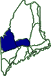 | ME | Moderate | 6.4 | summit, views, slab caves | Summer | 08/31/02
(01/20/08) | Webmaster | Bear Mtn.
(Red Trail, Orange Trail, White Trail, Yellow Trail) (trail map) | CT - Northwest
Bear Mountain Reservation
Danbury, CT |  | CT | Easy/Moderate | 3.5 | summit, lake | Variable |
(11/30/08) | Sunshyn | Beech Mtn.
(Valley Trail, Beech South Ridge Trail, Beech Mountain Trail) (trail map, photos) | ME - Central Southeast
Acadia National Park, Western Region
Southwest Harbor, ME |  | ME | Easy/Moderate | 2.4 | summit, views, cliffs, slab caves, fire tower, loop hike | Spring | 06/09/08
(10/22/09) | Webmaster | Beech Mtn., Beech Cliff, Canada Cliffs
(Beech Mountain Trail, Beech Cliff Loop Trail, Canada Cliff Trail, Valley Trail) (trail map, photos) | ME - Central Southeast
Acadia National Park, Western Region
Southwest Harbor, ME | | ME | Easy/Moderate | 4.5 | summit, views, cliffs, slab caves, fire tower, loop hike | Spring | 05/21/08
(10/22/09) | Chip Lary | The Beehive, Champlain Mtn., The Bowl
(Beehive Trail, Bowl Trail, Champlain South Ridge Trail) (trail map, photos) | ME - Central Southeast
Acadia National Park, Eastern Region
Bar Harbor, ME | | ME | Moderate | 4.9 | views, summits, pond, rock scrambles, cliffs, ledges | Spring | 05/21/09 | Chip Lary | The Beehive, Gorham Mtn., The Bowl, Thunder Hole, Sand Beach
(Ocean Trail, Bowl Trail, Beehive Trail, Gorham Mountain Trail) (trail map, photos) | ME - Central Southeast
Acadia National Park, Eastern Region
Bar Harbor, ME | | ME | Moderate | 5.4 | views, summits, pond, ocean, rock scrambles, cliffs, ledges, loop hike | Spring | 06/06/08
(07/18/09) | Webmaster | Belknap Mtn.
(Red Trail, Blue Trail, Belknap Range Trail) (trail map, photos) | NH - Central East
Lakes Region, Belknap Range
Gilford, NH | | NH | Moderate/Difficult | 1.9 | summit, views, fire tower, loop hike | Summer | 09/07/09
(09/17/09) | Mary | Belknap Ridge, Gunstock Mtn., Belknap Mtn., Round Pond, Mt. Klem, Rand Mtn., West Quarry Mtn., East Quarry Mtn., North Straightback Mtn., Mt. Major
(Brook Trail, Saddle Trail, Blue Trail, East Gilford Trail, Boulder Trail, Round Pond Link, Red Trail, Quarry Trail, Mount Major Trail) (trail map, photos) | NH - Central East
Lakes Region, Belknap Range
Gilford, NH | | NH | Moderate/Difficult | 10.4 | summits, views, ledges, fire tower, pond | Summer | 07/19/08
(09/06/09) | Chipmunk | Bellamy River Wildlife Sanctuary
(Border Trail, Cove Trail, Clement's Point Trail) (trail map) | NH - Southeast
Seacoast Region
Dover, NH | | NH | Easy | 1.5 | river, marsh, estuary, loop hike | Variable |
(04/08/09) | Phil Blampied | Bellamy River Wildlife Sanctuary
(Border Trail, Cove Trail, Clement's Point Trail) (trail map, photos) | NH - Southeast
Seacoast Region
Dover, NH | | NH | Easy | 1.5 | river, marsh, estuary, loop hike | Variable |
(04/08/09) | New Hampshire Natural Heritage Bureau | Big Rock Cave, Mt. Mexico
(Cabin Trail, Whitin Brook Trail, Big Rock Cave Trail) (trail map, photos) | NH - Central East
White Mountain National Forest, Sandwich Range Wilderness
Tamworth, NH | | NH | Moderate | 5.6 | summit, slab caves, brook, loop hike | Spring | 05/24/09
(09/18/09) | Bill Mahony | Big Rock Cave, Mt. Mexico
(Big Rock Cave Trail, Whitin Brook Trail, Cabin Trail) (trail map, photos) | NH - Central East
White Mountain National Forest, Sandwich Range Wilderness
Tamworth, NH | | NH | Moderate | 5.6 | summit, slab caves, brook, loop hike | Summer | 07/23/00
(09/18/09) | Webmaster | Black Mtn.
(Black Mountain Ski Trail, East Pasture X-C Ski Trail, Black Mountain Cutoff) (trail map, photos) | NH - Central East
White Mountain National Forest, Carter-Baldface Region
Jackson, NH | | NH | Moderate/Difficult | 3.5 | summit, views | Summer | 08/28/08 | James Horner | Black Pond, Franconia Falls
(Lincoln Woods Trail, Black Pond Trail, Franconia Falls Trail) (photos) | NH - Central East
White Mountain National Forest, Pemigewasset Wilderness
Lincoln, NH | | NH | Easy | 8.0 | pond, cascades, views, river, brooks | Spring | 05/12/07
(10/01/09) | Webmaster | Blueberry Mtn. (Evans Notch)
(Bickford Brook Trail, Blueberry Ridge Trail) (trail map, photos) | ME - Central Southwest
White Mountain National Forest, Caribou-Speckled Mountain Wilderness
Batchelders Grant, ME | 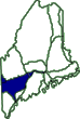 | ME | Moderate | 7.6 | summit, views, ledges, brook, loop hike | Fall | 10/13/07 | Dennis Marchand | Blueberry Mtn. (Moosilauke Region)
(Blueberry Mountain Trail) (trail map, photos) | NH - Central West
White Mountain National Forest, Moosilauke Region
Benton, NH | | NH | Easy/Moderate | 4.7 | summit, views, ledges | Summer | 09/01/07 | Webmaster | Boulder Loop Ledges (Moat Range)
(Boulder Loop Trail) (trail map, photos) | NH - Central East
White Mountain National Forest, Moat Region
Albany, NH | | NH | Moderate | 3.5 | views, ledges, loop hike, covered bridge | Winter | 02/14/10 | Karl Searl | Boulder Loop Ledges (Moat Range)
(Boulder Loop Trail) (trail map, photos) | NH - Central East
White Mountain National Forest, Moat Region
Albany, NH | | NH | Moderate | 3.5 | views, ledges, loop hike, covered bridge | Winter | 01/24/09
(06/11/10) | Diane King | Bridal Veil Falls
(Coppermine Trail) (photos) | NH - Central West
White Mountain National Forest, Cannon-Kinsman Region
Franconia, NH | | NH | Easy/Moderate | 5.0 | waterfall, cascades, brook | Summer | 07/13/02
(02/10/09) | Webmaster | Cadillac Mtn., Eagle's Crag, The Featherbed
(Cadillac South Ridge Trail, Campground Road, Park Loop Road) (trail map, photos) | ME - Central Southeast
Acadia National Park, Eastern Region
Bar Harbor, ME | | ME | Easy/Moderate | 7.3 | views, summits, pond, ocean, rock scrambles | Spring | 05/22/09
(08/15/09) | Chip Lary | Cannon Mtn.
(Lonesome Lake Trail, Kinsman Ridge Trail) (photos) | NH - Central West
White Mountain National Forest, Franconia Notch State Park
Franconia, NH | | NH | Moderate/Difficult | 6.2 | summit, views, lake, brooks, 4000-footer | Fall | 10/20/07
(09/01/19) | Mark Malnati | Mt. Cardigan
(West Ridge Trail) (photos) | NH - Central West
Cardigan State Park
Orange, NH | | NH | Moderate | 3.0 | summit, views, fire tower | Spring | 04/26/98 | Webmaster | Mt. Cardigan, Firescrew
(West Ridge Trail, Mowglis Trail) (photos) | NH - Central West
Cardigan State Park
Orange, NH | | NH | Moderate | 7.0 | summits, views, meteor showers, fire tower | Summer | 08/13/99
(01/20/08)
2 days | Webmaster | Mt. Cardigan, Mt. Cardigan South Peak, Orange Mtn. (Mt. Gilman), Rimrock
(Woodland Trail, Clark Trail, Vistamont Trail, Skyland Trail, South Ridge Trail, Hurricane Gap Trail, Holt-Clark Cutoff (Cathedral Forest Trail), Holt Trail, West Ridge Trail) (trail map, photos) | NH - Central West
Cardigan State Park
Alexandria, NH | | NH | Easy/Moderate | 6.7 | summits, views, cliffs, loop hike | Summer | 06/21/08 | Sue Murphy | Carleton Mtn.
(Long Trail) (trail map, photos) | VT - Northwest
Jay, VT |  | VT | Moderate | 2.4 | summit, views, orienteering/route finding | Spring | 03/25/08 | Webmaster | Mt. Carrigain, Signal Ridge
(Signal Ridge Trail) (trail map, photos) | NH - Central East
White Mountain National Forest, Carrigain Region
Livermore, NH | | NH | Moderate/Difficult | 10.0 | summit, views, ledges, brooks, cascades, fire tower, 4000-footer | Summer | 08/29/99
(10/02/09) | Webmaster | Mt. Carrigain, Signal Ridge, Vose Spur, Duck Pond
(Signal Ridge Trail, Carrigain Notch Trail, Bushwhack) (trail map, photos) | NH - Central East
White Mountain National Forest, Carrigain Region
Livermore, NH | | NH | Difficult | 11.3 | summits, views, ledges, brooks, cascades, fire tower, 4000-footer, orienteering/route finding, loop hike, backpack | Spring | 06/05/09
(10/02/09)
2 days | Bill Mahony | Carter Dome, Carter Lakes
(Bog Brook Trail, Wildcat River Trail, Carter-Moriah Trail, Rainbow Trail, Wild River Trail) (trail map) | NH - Central East
White Mountain National Forest, Carter-Baldface Region
Jackson, NH | | NH | Moderate/Difficult | 12.0 | summit, views, hut, lakes, 4000-footer, loop hike | Summer | 09/19/99
(01/20/08) | Webmaster | Castle in the Clouds - Lucknow, Fall of Song, Bridal Veil Falls, Shannon Pond
(Shannon Brook Trail, Brook Road, Tram Road) (photos) | NH - Central East
Lakes Region, Castle in the Clouds
Moultonborough, NH | | NH | Easy/Moderate | 4.0 | castle, cascades, waterfalls, gorges, brooks, pond, orienteering/route finding, loop hike | Winter | 01/27/08
(10/24/09) | Faye Doria | Catamount Hill
(Bear Brook Trail, Connector Trail, Catamount Hill Trail, Shortcut Trail, One Mile Road) (trail map, photos) | NH - Southeast
Bear Brook State Park
Allenstown, NH | | NH | Easy/Moderate | 2.3 | summit, views, brooks, loop hike | Winter | 01/01/09 | Deb Hann | Cherry Pond, Little Cherry Pond
(Presidential Range Rail Trail, Waumbek Link, Shore Path, New Hampshire Central Railroad, Little Cherry Pond Trail, Rampart Path, Colonel Whipple Trail, Cohos Trail, Whipple Road, Meadows Road) (trail map, photos) | NH - Central East
Pondicherry Wildlife Refuge
Jefferson, NH | | NH | Easy/Moderate | 9.1 | ponds, wetlands, views, bird watching, loop hike | Fall | 10/12/09
(01/05/11) | Webmaster | Cherry Pond, Little Cherry Pond
(Pondicherry Rail Trail, Presidential Range Rail Trail, Shore Path, Rampart Path, New Hampshire Central Railroad, Little Cherry Pond Trail, Cohos Trail) (trail map, photos) | NH - Central East
Pondicherry Wildlife Refuge
Whitefield, NH | | NH | Easy | 5.2 | ponds, wetlands, views, bird watching | Fall | 11/30/02
(01/04/11) | Webmaster | Cherry Pond, Little Cherry Pond
(Pondicherry Rail Trail, Presidential Range Rail Trail, Shore Path, Rampart Path, New Hampshire Central Railroad, Little Cherry Pond Trail, Cohos Trail) (trail map, photos) | NH - Central East
Pondicherry Wildlife Refuge
Whitefield, NH | | NH | Easy | 5.8 | ponds, wetlands, views, bird watching | Variable |
(01/11/11) | New Hampshire Natural Heritage Bureau | Chesterfield Gorge
(Wilderness Loop Trail) (trail map, photos) | NH - Southwest
Chesterfield Gorge State Park
Chesterfield, NH |  | NH | Easy/Moderate | 0.7 | gorge, brook, waterfalls, cascades, loop hike | Summer | 07/24/09
(08/08/09) | Jeff Littlejohn | Mt. Chocorua, First Sister, Champney Falls, Pitcher Falls
(Champney Falls Trail, Champney Falls Loop, Piper Trail, Middle Sister Trail) (trail map, photos) | NH - Central East
White Mountain National Forest, Chocorua Region
Albany, NH | | NH | Moderate | 8.4 | summits, views, brooks, waterfalls, ledges, rock scrambles | Spring | 04/05/09
(04/23/09) | Bill Mahony | | College Woods | NH - Southeast
Seacoast Region
Durham, NH | | NH | Easy | variable | brook, reservoir | Variable | | Phil Blampied |
|