Little Long Pond and Seal Harbor Beach
| Destinations: | Little Long Pond (20'), Seal Harbor Beach (0') | |
| Trails: | Seaside Path, Jordan Stream Path, carriage roads, Seaside Lane, Route 3 | |
| Region: | ME - Central Southeast Acadia National Park, Eastern Region | |
| Location: | Bar Harbor, ME | |
| Rating: | Easy | |
| Features: | Pond, ocean, beach, brook, cascades, loop hike | |
| Distance: | 4.9 miles | |
| Elevation Gain: | 300 feet (cumulative) | |
| Hiking Time: | Typical: 2:35 | |
| Outing Duration: | Actual: 3:30 Typical: 4:00 | |
| Season: | Spring | |
| Hike Date: | 05/19/2009 (Tuesday) | |
| Last Updated: | 07/31/2009 | |
| Weather: | Sunny and cool (upper 50's to low 60's) | |
| Author: | Chip Lary |
Route Summary
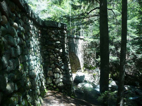
This lovely loop visits Seal Harbor Beach, Little Long Pond, Jordan Stream, and the only bridge in Acadia National Park that is faced with cobblestones rather than granite blocks. A special benefit of this route is that it follows the lightly used, but attractive Seaside Path and Jordan Stream Path. It also makes use of a carriage road and a section along Route 3 in order to complete the loop.
First, in order to clear up any confusion, a few notes on names:
- The pond on this route may be called Little Long Pond, (Little) Long Pond, or simply Long Pond. The "little" comes into play to differentiate it from another "Long Pond" located in the western part of the park. Little Long Pond, in the eastern part of the park is 38 acres, and Long Pond (sometimes called Great Long Pond) is 897 acres.
- Seaside Path may also be referred to as Seaside Trail. The park service has renamed several trails so you may come across either name on signs and other references.
- Jordan Stream Path may also be referred to as Jordan Stream Trail. This is another route that underwent a name change as part of the park's management plan. Many of the changes revert to an earlier historical name.
And here are the route directions:
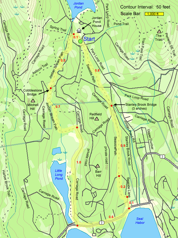
- Pick up Seaside Path on the opposite side of the parking lot from the Jordan Pond House. Leave the parking lot and take a right onto a carriage road. Then take an immediate left onto the start of Seaside Path. Unlike most other trails in Acadia the beginning is not well marked; there is only a small signpost on a tree. If you do not see the trailhead by the time you have reached an intersection of carriage roads, you have gone too far.
- Once on Seaside Path, it is easy to follow. Proceed for 0.8 mile which will bring you beneath Stanley Brook Bridge. This is a three-arched bridge. From west to east the arches span Seaside Path, Stanley Brook Road, and Stanley Brook.
- Continue on Seaside Path for another 0.9 mile where you will meet Seaside Lane.
- Cross the street and continue on Seaside Path for almost 0.2 mile where the trail ends upon meeting a different portion of Seaside Lane.
- Turn right onto Seaside Lane and walk for about 0.1 mile until meeting Route 3. Across the street is the public Seal Harbor Beach which you can explore.
- Walk west (turn right when coming from Seaside Lane; or left when leaving the beach) on Route 3 for 0.6 mile.
- At a wooden gate on the right, turn right onto a carriage road. This carriage road is outside of the park so bicycles are not allowed but walkers are welcome. You will immediately see Little Long Pond on the left and can walk down to check it out up close if you like.
- Continue on the carriage road for 1.0 mile and then turn left off of the carriage road and onto Jordan Stream Path.
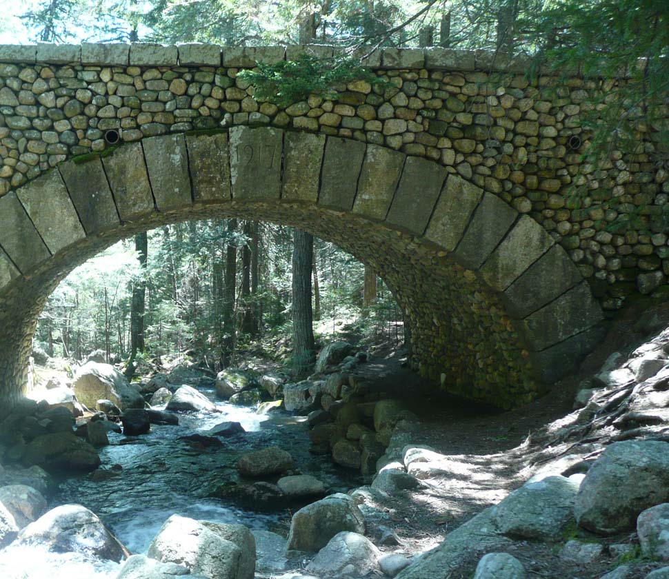
- Follow Jordan Stream Path for 0.7 mile to reach the cobblestone bridge.
- Continue on Jordan Stream Path for 0.5 mile which will bring you to a carriage road at junction #15.
- Cross the carriage road and walk up some stone steps to arrive at the rear of Jordan Pond House.
- Walk across the open area for 0.1 mile to return to the parking lot that you started from.
| Place | Split Miles |
Total Miles |
||
|---|---|---|---|---|
| Seaside Path Trailhead (300') | 0.0 | 0.0 | ||
| Seal Harbor Beach (0') | 2.0 | 2.0 | ||
| Little Long Pond (20') | 0.6 | 2.6 | ||
| Jct. carriage road/Jordan Stream Path (60') | 1.0 | 3.6 | ||
| Seaside Path Trailhead (300') | 1.3 | 4.9 |
|
|
|||||
|
|
|||||
|
|
|||||
Trail Guide
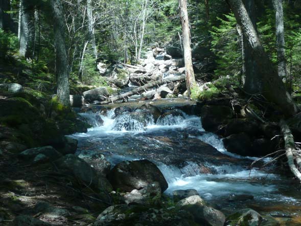
This loop avoids the crowds of people that go to Jordan Pond House. You take in mossy forest trails, the ocean, a beach, a pond, a rushing stream with many small falls, and the only cobblestone bridge in the Acadia National Park Carriage Road system.
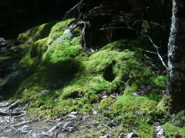
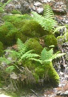
First, take Seaside Path south from Jordan Pond House down to Seal Harbor. Not far from the trailhead, Seaside Path soon passes just to the right of the dorms for the Jordan Pond workers. It quickly becomes very private – a quiet walk through the woods. The path has heavy moss on both sides, in several varieties. The trail drops gently all the way to the ocean. The trail ends by coming to a paved, private road (Seaside Lane). Take a right and walk down this road to Route 3. We did not see any large wildlife on the path, but when we stepped onto the private road a deer bounded across in front of us.
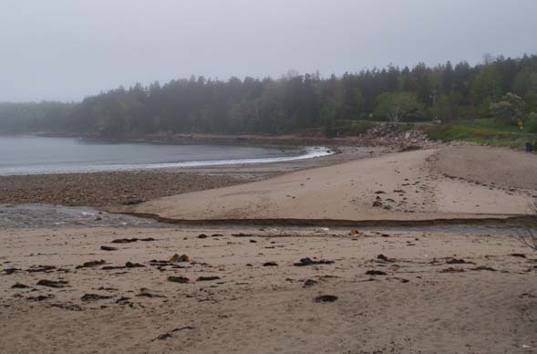
Once you reach Route 3 you can cross it and step down onto Seal Harbor Beach. It is public and you can find sea glass, sand dollars, and polished stones on it.
When you are done beachcombing, the hike continues by walking west on Route 3 (from where the private road meets Route 3, take a right.) There is some traffic on this road, but much of the walk includes a sidewalk and/or enough space to safely walk beside the highway. After about a half a mile you will see on the right a wooden gate marking the end of a carriage road. Walk through this gate onto the carriage road.
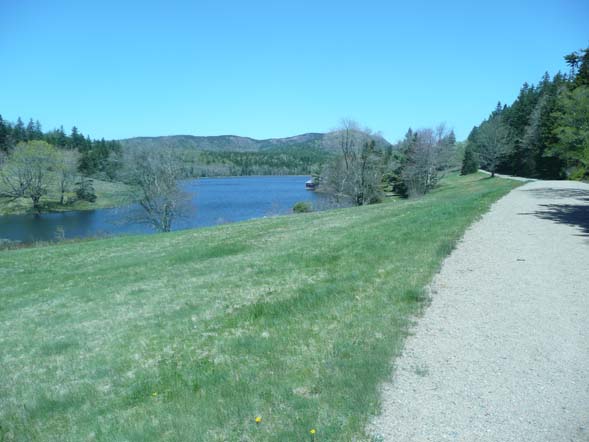
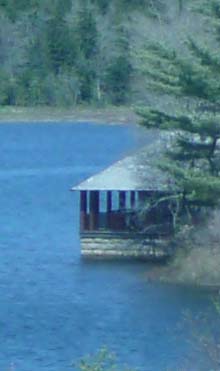
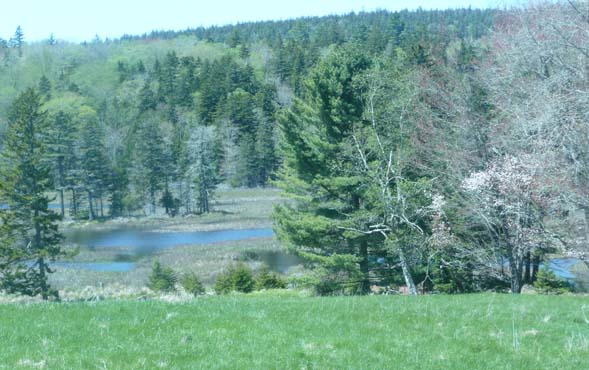
You will immediately see Little Long Pond on the left. You can head over towards it and visit the Long Pond Boat House (in the photo above you can just see the boat house jutting into the water from the right-hand shoreline). Continue up the carriage road for about one mile. The start of Jordan Stream Path is on the left and is well marked with the standard Acadia National Park wooden trail marker.
Once onto the trail you may need to watch for some blazes (pieces of wood nailed to trees; not paint on trees) because the trail is not traveled enough at this end for it to be well worn. You shortly come to Jordan Stream.
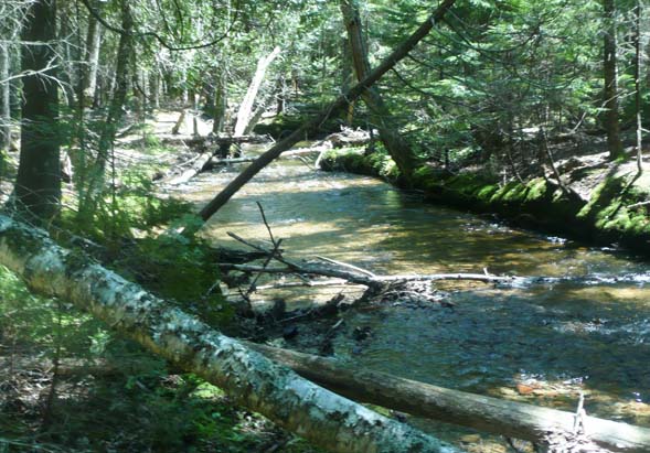
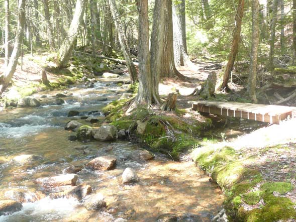
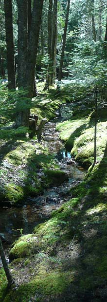
The trail is now relatively easy to follow since it travels right up Jordan Stream. It periodically crosses back and forth over the brook, so that you end up hiking on both sides. There are bridges or rocks where you cross over, so there is no wading required.
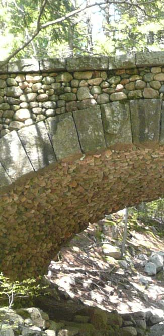
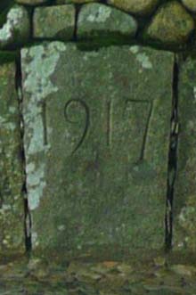
As you travel upstream you will come to the only cobblestone bridge in the entire Acadia National Park Carriage Road system. All the other bridges were built with native granite. Even the underside of the arched bridge is faced with cobblestones. The keystone on the arch has "1917" engraved in it. The trail passes directly under the bridge, but you can walk up around and take pictures from on top of it, too. Check out the photo at the very bottom of this page to get a look at the hiking trail passing under the right-hand side of the bridge.
From this point continue following the trail upstream. You will intersect with carriage roads a couple more times before finally coming to carriage road intersection #15. Directly across the carriage road is a set of stone steps. Walk up these and you come out right behind the Jordan Pond House very near the parking lot you started from.
This is an easy hike with no steep sections at all, either going down to the ocean or back up to Jordan Pond House. With the exception of Seal Harbor Beach I only saw one other person the entire hike – a woman riding a horse on the carriage road. This made for a quiet, peaceful walk with the ability to stop and enjoy whatever views I wanted.
|
|
|||||
|
|||||

Parking for this hike is at the Jordan Pond House parking area off of Park Loop Road in Bar Harbor, Maine.
From the North:
- From Hull's Cove Visitor Center, which is just off of Route 3, get on Park Loop Road.
- Follow Park Loop Road south (on the two-way travel section) for 7.7 miles until reaching the Jordan Pond House area on the right.
- Turn right into the parking lot for the Jordan Pond House.
- Seaside Path starts near the end of the parking lot that is on the opposite side from the Jordan Pond House.
From Bar Harbor:
- From the junction of Routes 3 and 233 in Bar Harbor, pick up Rt. 233 West.
- Travel on Rt. 233 West for 1.2 miles.
- Turn left/south onto Park Loop Road.
- Follow Park Loop Road south (on the two-way travel section) for 5.1 miles until reaching the Jordan Pond House area on the right.
- Turn right into the parking lot for the Jordan Pond House.
- Seaside Path starts near the end of the parking lot that is on the opposite side from the Jordan Pond House.
Winter:
- Because most of Park Loop Road is closed in the winter, use this alternate driving route to reach this hike in the winter.
- Follow Rt. 3 south from Bar Harbor village into Acadia National Park. From the sharp right-hand turn in downtown Bar Harbor, travel on Rt. 3 for about 7.7 miles.
- Turn right onto Jordan Pond Road and follow it for 0.8 mile where it meets Park Loop Road.
- Turn left on Park Loop Road and proceed about 0.5 mile to the parking area on the left for the Jordan Pond House.
- The parking lot that's plowed may not be the same one that's accessible in the summer. Look for the trail to start south-southeast from the Jordan Pond House; the winter parking area might be a bit north of the one used in the summer.
Facilities
Bathrooms at Jordan Pond House.
Other Notes
A fee is required to enter Acadia National Park between May 1st and October 31st.
For more information on entrance fees please refer to the Acadia National Park website.
Rates:
- $20 for a week-long pass for one vehicle during the regular season (June 23rd–Early October)
- $10 for a week-long pass for one vehicle during the off-season (May 1st–June 22nd and Early October–October 31st)
- $40 for a year-long pass for one vehicle
- $5 for a week-long pass for one pedestrian
About Acadia National Park
Acadia National Park, covering about 48,000 acres, is located on Mount Desert Island on the coast of the Atlantic Ocean in the "Downeast" region of the state of Maine. The park spans several villages including Bar Harbor, Northeast Harbor, and Southwest Harbor. Acadia includes miles of ocean shoreline, many freshwater ponds, a couple lakes, waterfalls, bare ledgy mountaintops, and deciduous and softwood forests. There are two sections of the park that are not on Mount Desert Island: Schoodic Peninsula and Isle au Haut.
Acadia National Park offers a unique hiking experience in New England. From the many bare summits, not only can you see other mountains, but also gorgeous vistas of the sea along with islands, promontories, coves, and boats. The hiking is rugged with many easy rock scrambles, yet the elevations are low, making the ledgy peaks accessible to most people. The incredible network of trails allows you to tailor hiking distances to your wishes – you can devise a route that will keep you going all day; or simply choose a short jaunt to give you great vistas without a lot of effort. There are a couple dozen peaks and well over 100 miles of hiking trails.

There is an abundance of opportunities for outdoor activities at Acadia. Spend some time sunbathing at Sand Beach, enjoy a leisurely stroll along the Atlantic shoreline, bicycle or ride a horse on the 57 miles of carriage roads, paddle in the many ponds, swim at Echo Lake, take a boat tour on the sea or to an island, stay overnight at the park's campgrounds, and of course you can hike up mountains, through forests, and around ponds. The winter season provides great terrain for cross-country skiing and snowshoeing.
If your taste runs to less physical activity, then you can drive up to the summit of Cadillac Mountain – Acadia's highest peak at 1,532 feet elevation – in fact the highest point on the United States' Atlantic seaboard. From Cadillac's bare summit are views in every direction – you can watch the sunrise in the morning and the sunset in the evening. The forest service offers many ranger-led programs from mid-May through mid-October to introduce you to the nature and wildlife of the park. You can drive on Park Loop Road for a tour of the park with many picnic areas and pullout spots offering scenic vistas available. Or stop in at Jordan Pond House for popovers and tea. Shopping, restaurants, and lodging are available in Bar Harbor as well as the other villages within or next to the park. Whale watching and bird watching are other popular activates.

The varied natural habitat of Acadia National Park – from ocean to mountains – offers a plethora of plants and wildlife – both marine and land-bound. It is home to about 50 species of mammals, 325 bird species, and 1,000 species of flowering plants. Both bald eagles and peregrine falcons nest on the island. Mammals include deer, porcupine, and beaver. Whales and harbor seals are common marine animals.
The park was established in 1916 under a different name and became Acadia National Park in 1929. John D. Rockefeller, Jr. donated about one-third of the park's acreage and was responsible for creating the gorgeous carriage roads that wind through forests, around ponds, past waterfalls, and over beautiful granite bridges.
An entrance fee is required to enter the park. See the forest service's Fees and Reservations page for more information.
The park is open all year, although services are reduced and many roads closed during the winter season.
Acadia National Park
P.O. Box 177
Bar Harbor, ME 04609
207.288.3338
Website by
![]() LeapfrogProgramming.com
LeapfrogProgramming.com
© 1998-2026
![]()
| The information on this site may freely be used for personal purposes but may not be replicated on other websites or publications. If you want to reference some content on this site, please link to us. |


