
North Moat, Red Ridge, Diana's Baths Loop
| Destinations: | North Moat Mtn. (3196'), Diana's Baths (750') | |
| Trails: | Moat Mountain Trail, Red Ridge Trail | |
| Region: | NH - Central East White Mountain National Forest, Moat Region | |
| Location: | Conway, NH | |
| Rating: | Difficult | |
| Features: | Summit, views, loop hike, brooks, cascades, ledges, rock scrambles | |
| Distance: | 10.2 miles | |
| Elevation Gain: | 2700 feet (cumulative) | |
| Hiking Time: | Typical: 6:30 | |
| Outing Duration: | Actual: 8:00 Typical: 9:30 | |
| Season: | Summer | |
| Hike Date: | 09/20/2008 (Saturday) | |
| Weather: | Sunny, clear | |
| Author: | Diane King | |
| Companions: | Twelve SDHers, two dogs |

Route Summary
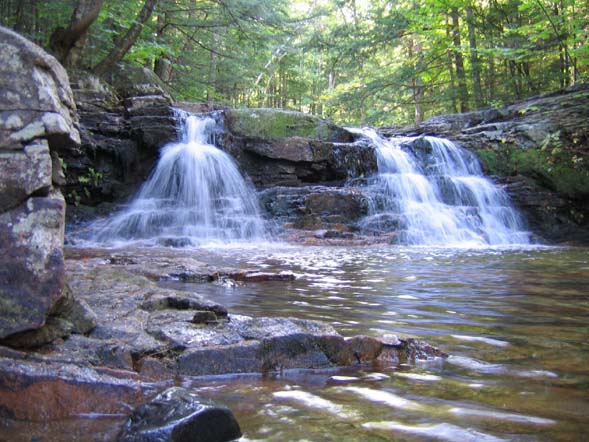
This is a loop hike going up Red Ridge with fantastic views along the way and summiting North Moat Mountain which offers a 360-degree panorama. The loop will also bring you to Diana's Baths which is a beautiful ledgy area with a series of cascades and pools formed by Lucy Brook.
 Ascent:
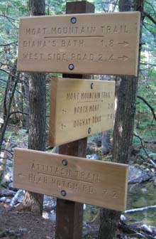
- Start on Moat Mountain Trail at its northeast trailhead on West Side Road. (Not to be confused with the southern terminus of Moat Mountain Trail which is accessed via Dugway Road.)
- Follow the easy (in this section) Moat Mountain Trail for 0.6 mile which will bring you to Diana's Baths.
- Continue on Moat Mountain Trail at the upper end of the clearing close to the the baths and then follow it along the north side of Lucy Brook, still with very easy grades, for 0.6 mile.
- At a fork, Red Ridge Trail goes left and Moat Mountain Trail stays straight. Cross the brook (difficult at high water) to take Red Ridge Trail to the left.
- Follow Red Ridge Trail for 0.8 mile, ascending gently, which will bring you to a junction with Red Ridge Link on the left; keep going straight to stay on Red Ridge Trail.
- After 0.7 mile on a gentle descent you will cross the gravel forest road FR 379, also called Red Ridge Road.
- Going another 0.5 mile on Red Ridge Trail, now starting to climb, will bring you to a stream crossing of Moat Brook.
- Cross the brook then climb steeply up Red Ridge Trail for 1.6 miles to its end where it meets Moat Mountain Trail. To offset the strenuous ascent, you will have many great views on open ledges on the way up.
- At the T-junction with Moat Mountain Trail turn right; but first, this junction makes for a good spot to take a break with the great views it offers.
- Follow Moat Mountain Trail northwest for 1.1 miles through alternating easy and steep sections to finally arrive at the wide-open summit of North Moat Mountain.

Descent:
- From the summit, continue on Moat Mountain Trail in a northeasterly direction, across several ledges and descending steeply to arrive at a junction with Attitash Trail after 1.9 miles.
- At this T-junction, Attitash Trail goes left while Moat Mountain Trail goes right; turn right to continue the descent on Moat Mountain Trail.
- Descend on easy grades for 1.2 miles which will bring you back to the lower junction with Red Ridge Trail; stay straight on Moat Mountain Trail. Just 0.2 mile before reaching the junction you will cross Lucy Brook (difficult at high water).
- After another easy 0.6 mile you will again encounter Diana's Baths.
- Descend gently from the baths for 0.6 mile, still on Moat Mountain Trail, to return to the trailhead and finish the hike.

| Place | Split Miles |
Total Miles |
||
|---|---|---|---|---|
| Moat Mountain Trailhead on West Side Rd. (550') | 0.0 | 0.0 | ||
| Diana's Baths (750') | 0.6 | 0.6 | ||
| Lower jct. Moat Mountain Trail/Red Ridge Trail (750') | 0.6 | 1.2 | ||
| Jct. Red Ridge Trail/Red Ridge Link (950') | 0.8 | 2.0 | ||
| Jct. Red Ridge Trail/Red Ridge Rd. (900') | 0.7 | 2.7 | ||
| Jct. Red Ridge Trail/Moat Brook crossing (1160') | 0.5 | 3.2 | ||
| Upper jct. Moat Mountain Trail/Red Ridge Trail (2760') | 1.6 | 4.8 | ||
| North Moat Mtn. summit (3196') | 1.1 | 5.9 | ||
| Jct. Moat Mountain Trail/Attitash Trail (1080') | 1.9 | 7.8 | ||
| Lower jct. Moat Mountain Trail/Red Ridge Trail (750') | 1.2 | 9.0 | ||
| Diana's Baths (750') | 0.6 | 9.6 | ||
| Moat Mountain Trailhead on West Side Rd. (550') | 0.6 | 10.2 |


|
|
|||||

|
|
|||||

|
|
|||||

Trail Guide
Although this hike had many easy sections, there were steep segments which were long enough to warrant a Difficult overall rating using HikeNewEngland.com's guidelines. Being avid hikers we initially thought this would be a Moderate hike but by the time we were finished had upgraded it to Moderate/Difficult based on the relative abilities of our hiking club.
From Diana's Baths parking lot, three hikers and two dogs departed at the scheduled 8:45 meeting time. The remaining nine departed to the baths and then up Red Ridge Trail around 9:10 due to a late arrival.

The air was crisp and cool and the skies were sunny as we strolled a couple miles through hardwoods. We then came to a junction with a logging road and turned left in error. We walked ten minutes or so and brilliantly assessed that the flat terrain/horizon ahead would not be taking us up the advertised "steep side" of the mountain. We turned back and found our path had an arrow pointing back into the hardwoods from across the logging road where we met up with Green Mountain Club doing the same loop.
We began to climb a little on Red Ridge Trail and then came to rocks and ledges and rested at an awesome lookout area where we could see North Conway and the fire tower on North Kearsarge. We journeyed longer and happened upon more hikers. We inquired about and found our group to be quite on track. It was past noon and we were ready for lunch. We stopped at the junction of Red Ridge and Moat Mountain Tails.

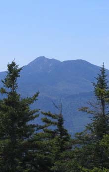
Afterwards, we headed over the beautiful wooded ridge and up some long and steep rocks for the next 1.1 miles and met up with our people, including Richard the singing hiker, on the summit of North Moat Mountain. We enjoyed a 360-degree view with clear skies and limited wind.
We all started the descent together a bit gingerly down the steep ledges of Moat Mountain Trail with a little skidding–okay, maybe an actual fall or two. Those in front waited up at brook crossings and/or junctions until those behind caught up and piggybacked our way to the bottom.
Everyone was appreciative of the trails, the peak and the views. I think somewhere slipping down the side of the North Moat ledges we decided perhaps it is a Moderate/Difficult rather than a Moderate hike, especially factoring in the 10+ miles and 7.5+ hours we were putting in.
|
|
|||||

|
|||||


The northeast Moat Mountain Trailhead is located in Conway, New Hampshire. There is a large parking area that is referred to as the "Diana's Baths" lot.
From Rt. 16 in North Conway:
- Turn west at the traffic lights in front of Eastern Slope Inn onto River Road.
- Drive 2.2 miles on River Road and West Side Road to the parking area for Diana's Baths on the left.
 From Rt. 16 in Conway:
- Turn north onto Washington Street at a 4-way junction where the road going south is Rt. 153 (with Rt. 16 running east-west at this point). Following Rt. 16 North, Washington Street is at the very first set of lights after you pass the junction of Routes 16 and 112 (the Kancamagus Highway).
- Next bear left at the fork onto West Side Road but do not go over the covered bridge.
- Continue north to a T-intersection of West Side Road and River Street and take a left to stay on West Side Road.
- You will then pass Cathedral Ledge Drive on the left and pass over Lucy Brook on a narrow bridge.
- Turn left into the parking area for Diana's Baths.
Facilities
Bathrooms at the parking lot.

Other Notes
WMNF Recreational Pass
A parking permit is required to park at White Mountain National Forest trailheads and parking areas. You can purchase a WMNF permit from the forest service and other vendors and can also pay-by-the-day using self-service kiosks located in many parking areas.
For more information on parking passes please refer to the White Mountain National Forest website.
Rates:
- $5 per day
- $30 for a year-long pass
- $40 for a year for a household
More Moat Mountain Trail Reports


Website by
![]() LeapfrogProgramming.com
LeapfrogProgramming.com
© 1998-2024
![]()
| The information on this site may freely be used for personal purposes but may not be replicated on other websites or publications. If you want to reference some content on this site, please link to us. |

